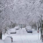
Dec. 23, 2022, Toronto: A massive cross-country winter storm unleashes destructive winds and heavy snow, causing hundreds of airline cancellations and power outages from Canada’s coast to coast.
The “bomb cyclone” that blew in on Thursday night is expected to stick around during the holiday weekend.
What is a bomb cyclone? According to Global News chief meteorologist Anthony Farnell, most of Ontario and southern Quebec have met the threshold of a “bomb cyclone.” Farnell said the storm is arriving from the U.S. Midwest. A front of cold air is moving down from the Arctic, sending temperatures plunging.
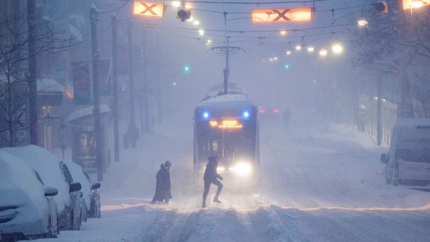
In the United States, the National Weather Service calls the winter storm a “once-in-a-generation type event.” It has turned deadly in the U.S., where at least six people have died in vehicle accidents during the treacherous weather.
The storm will impact everyone as it moves from Western Canada and into Ontario, Quebec and Atlantic Canada. Peter Kimbell, a warning preparedness meteorologist with Environment Canada, said it would be a multi-day weather event with fluctuating temperatures that could cause treacherous driving conditions. to know about extreme winter weather storming across North America. Kimbell said Friday would be the worst day for travel, particularly for Ontarians, and that is why the weather agency is issuing the alert early as the Christmas holidays approach.
About 320,000 people across the country are already facing power outages, according to an outage tracker from the generator company Generac, which aggregates data from providers across the country.
Air travel has also been severely impacted due to extreme weather conditions. Ontario, Quebec and British Columbia airportsanada and Flair Airlines have also cancelled a number of their scheduled flights.
How common are such storms in Canada?
“We may only see one of these storms every five or ten years,” Environment Canada meteorologist Mitch Meredith told The Canadian Press on Friday. “I’ve only seen a couple of storms like this in the last 20 years.”
That trend will probably last through the first half of January before shifting to an “icy” end of January and a possible start to February.
This season will also be the third-consecutive La Niña winter Canadians have experienced, Farnell added. La Niñas develop over the Pacific region due to colder-than-normal water temperatures and impact the weather pattern across Canada.
“Very rarely have we had three years in a row of La Niña,” he said, adding that La Niña winters play out similar to previous ones; 2022 started with freezing weather across the country.